Want more images or videos?
Request additional images or videos from the seller
1 of 13

Blaeu Virginia and Florida Map – Decorative Early America Chart, 1642

$6,224.05
£4,600.40
€5,250VAT Included
CA$8,584.59
A$8,634.85
CHF 5,031.28
MX$105,202.94
NOK 57,863.05
SEK 59,355.89
DKK 40,025.04

About the Item

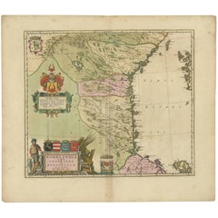
Blaeu Virginia and Florida Map – Decorative Early America Chart 1642 A highly important and visually striking map of the southeastern coast of North America, titled Virginiae partis australis, et Floridae partis orientalis, interjacentiumque regionum nova descriptio, published by Willem and Joan Blaeu in Amsterdam around 1642. This finely engraved map originates from Blaeu’s celebrated atlas Toonneel des Aerdrycx, produced at the height of the Dutch Golden Age of cartography. The map depicts the coastal regions of present-day Virginia, the Carolinas, Georgia, and Florida, extending inland to show early interpretations of the North American interior. The coastline is crisply delineated, reflecting European navigation and colonial interest in the region, while inland areas are rendered with pictorial mountain ranges, rivers, and settlements. The composition reflects a moment in time when knowledge of North America was still evolving, making it both historically fascinating and visually compelling. A defining feature of the map is its elegant Baroque cartouche at the top center, flanked by finely engraved indigenous figures, adding both decorative richness and ethnographic interest. The seas are animated with sailing ships and multiple compass roses, intersected by rhumb lines that create a dynamic maritime aesthetic. The balance between geographic detail and decorative elements makes this one of Blaeu’s most attractive maps of early America. Original hand-coloring enhances the map beautifully, with soft yet vivid tones highlighting borders, coastlines, and regions. The delicate coloring, combined with the crisp engraving, gives the piece a refined and highly decorative appearance, suitable for both collectors and interior designers. Maps of early America by Blaeu are particularly sought after due to their historical significance and strong visual appeal. This example stands out as a classic representation of the southeastern United States during the 17th century and is highly desirable as both a collector’s item and a statement decorative piece. A superb addition to any collection of early American cartography, and especially effective as a centerpiece in a study, library, or high-end interior. Condition: Good condition for its age. Original central fold as issued. Light overall toning consistent with age. Minor wear and some faint staining, mainly in the margins. Edges slightly irregular. Colors remain strong and attractive. Please study image carefully. Framing: This piece presents beautifully in a dark walnut or ebonized wood frame with a wide warm ivory mat. A museum-style presentation enhances the decorative cartouche and coastal detail. Particularly effective in a darker study or classic interior setting. Keywords: Virginia, Florida, Carolinas, Georgia, early America, North America, Willem Blaeu, Joan Blaeu, Dutch cartography, antique map America, 17th century map, Toonneel des Aerdrycx, colonial America, southeast United States, maritime navigation, compass rose, cartouche, decorative map Special note: This is an original 17th-century map, not a reproduction. All items we offer are authentic period works of art over 100 years old. The map is sold unframed; any framed images are shown for presentation and interior inspiration only and may not always be on scale with the original. Technique: Copperplate engraving with original hand-coloring Maker: Willem & Joan Blaeu, Amsterdam, c.1642
  • Dimensions:
    Height: 19.69 in (50 cm)Width: 23.23 in (59 cm)Depth: 0.01 in (0.2 mm)
  • Materials and Techniques:
    Paper,Engraved
  • Place of Origin:
  • Period:
    Mid-17th Century
  • Date of Manufacture:
    1642
  • Condition:
    Good condition for its age. Original central fold as issued. Light overall toning consistent with age. Minor wear and some faint staining, mainly in the margins. Edges slightly irregular. Colors remain strong and attractive.
  • Seller Location:
    Langweer, NL
  • Reference Number:
    Seller: HP-0841stDibs: LU3054349742012

More From This Seller

View All
Blaeu Map of Galicia Spain, Decorative Dutch Golden Age Map, 1642

Blaeu Map of Galicia Spain, Decorative Dutch Golden Age Map, 1642

Located in Langweer, NL

Blaeu Map of Galicia Spain & Santiago de Compostela, circa 1642 Fine original hand-colored copperplate engraved map of Galicia in northwestern Spain, engraved and published by Wille...

Category

Antique Mid-17th Century Dutch Maps

Materials

Paper

Blaeu Brazil Map, Novus Brasiliae Typus, Antique Hand-Colored Map 1642

Blaeu Brazil Map, Novus Brasiliae Typus, Antique Hand-Colored Map 1642

Located in Langweer, NL

Blaeu Brazil Map, Novus Brasiliae Typus, Antique Hand-Colored Map 1642 A highly important and visually striking map of Brazil, titled Novus Brasiliae Typus, published by Willem and ...

Category

Antique Mid-17th Century Dutch Maps

Materials

Paper

Blaeu Map of Portugal – Portugallia et Algarbia, Antique Iberia Map, 1642

Blaeu Map of Portugal – Portugallia et Algarbia, Antique Iberia Map, 1642

Located in Langweer, NL

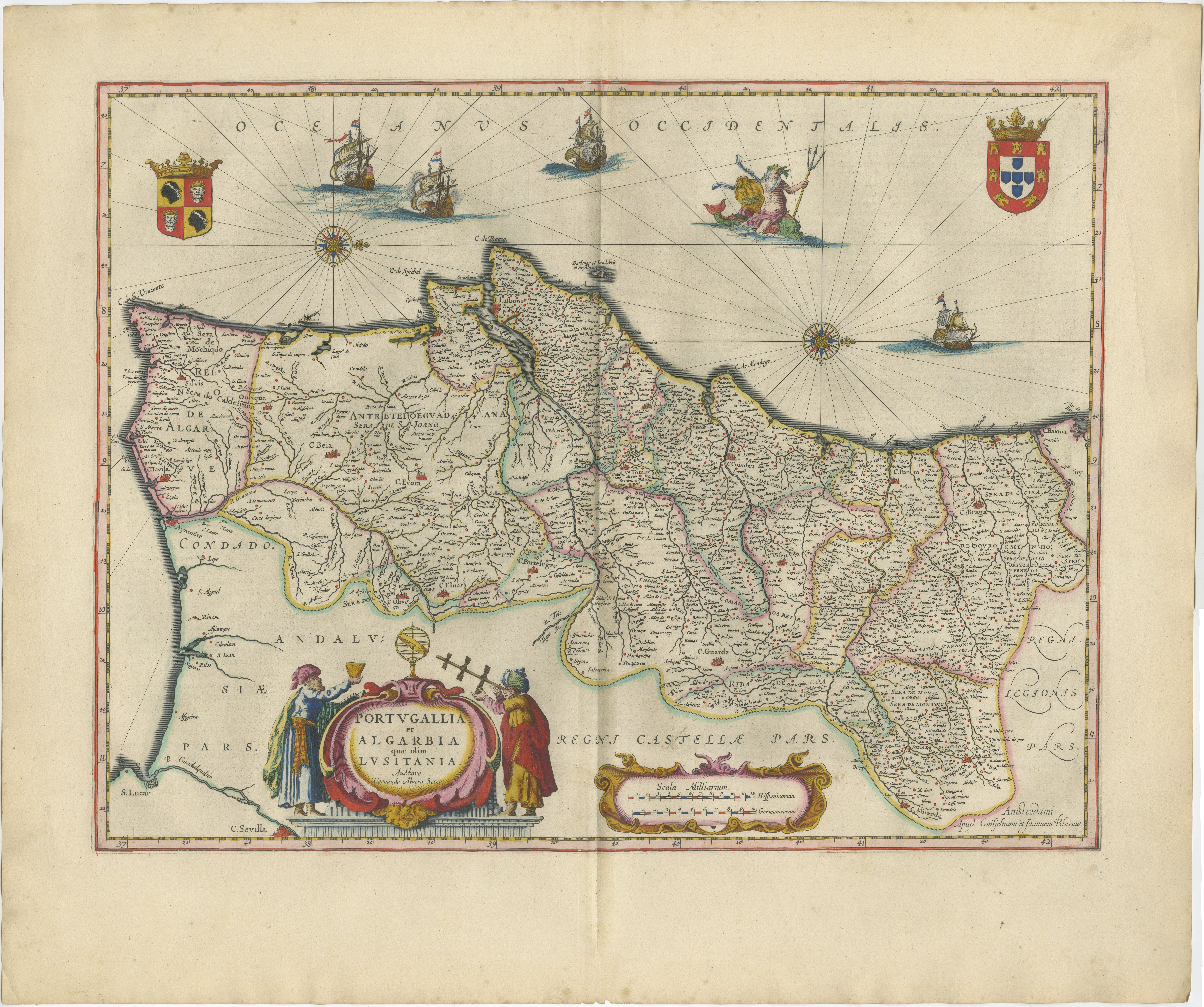
Blaeu Map of Portugal – Portugallia et Algarbia, Antique Iberia Map, 1642 A highly decorative and historically important map of Portugal, titled Portugallia et Algarbia quae olim Lu...

Category

Antique Mid-17th Century Dutch Maps

Materials

Paper

Antique Map of Central Sweden by J. Blaeu, 1662

Antique Map of Central Sweden by J. Blaeu, 1662

Located in Langweer, NL

A striking, rare map with a cartouche dedicated to Gabriel Bengtsson Oxenstierna. Published by J. Bleau, Amsterdam, 1662. Contemporary coloring.

Category

Antique Mid-17th Century Maps

Materials

Paper

Blaeu Biscay Map, Basque Country Bilbao Cantabria Spain, c.1642

Blaeu Biscay Map, Basque Country Bilbao Cantabria Spain, c.1642

Located in Langweer, NL

Blaeu Biscay Map, Basque Country Bilbao Cantabria Spain, c.1642 Description: A finely engraved and highly decorative map of northern Spain, depicting the historic regions of Biscay,...

Category

Antique Mid-17th Century Dutch Maps

Materials

Paper

Blaeu Catalonia Map, Barcelona & Mediterranean Coast Spain, c.1642

Blaeu Catalonia Map, Barcelona & Mediterranean Coast Spain, c.1642

Located in Langweer, NL

Blaeu Catalonia Map, Barcelona Spain, Mediterranean Sea, c.1642 Description: A superb and highly detailed map of Catalonia, centered on Barcelona and the northeastern regions of Spa...

Category

Antique Mid-17th Century Dutch Maps

Materials

Paper

You May Also Like

Antique Map - Gallia - Etching by Johannes Janssonius - 1650s

Antique Map - Gallia - Etching by Johannes Janssonius - 1650s

By Johannes Janssonius

Located in Roma, IT

Antique Map - Gallia is an antique map realized in 1650 by Johannes Janssonius (1588-1664). The Map is Hand-colored etching, with coeval watercoloring. Good conditions with slight ...

Category

1650s Modern Figurative Prints

Materials

Etching

Cadiz Island: A Framed 17th Century Hand-colored Map from Blaeu's Atlas Major

Cadiz Island: A Framed 17th Century Hand-colored Map from Blaeu's Atlas Major

By Joan (Johannes) Blaeu

Located in Alamo, CA

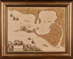
This is a 17th century hand-colored map entitled "Insula Gaditana Isla de Cadiz" from Johannes (Joan) Blaeu's Atlas Maior, published in Amsterdam in 1662. The map provides an excellent plan of Cadiz Island on the southwest coast of Spain, with its harbor, fortifications, agricultural fields and several surrounding salt processing areas. Numerous sailing ships of various sizes are included in and around the harbor and bay, including five large sailing ships, as well as twenty-four smaller ships. There is a small compass rose overlying the bay. The bridge to the mainland from the island is shown on the right. There is an extremely ornate and colorful title cartouche in the lower left, with its mythological figures reminiscent of Raphael’s Galatea fresco at the Villa Farnesina in Rome. The vibrant colors are vividly preserved. The master colorist tried to emulate a painting by using various tones to create a three-dimensional effect.
 Blaeu's name is present in the plate in the lower right. Blaeu stated in his description of Cadiz: “The main wealth of the islanders consists of salt, which they harvest, and
 the tuna fisheries.” 
 This 17th century hand-colored map is framed in an ornate, partially textured bronze-colored wood frame and glazed with UV protected conservation glass. There is a vertical center fold, as issued. There is a faint crease in the lower right and faint color offset on the left from the right side of the map, resulting from having been in an atlas for hundreds of years. Small foci of paint are present in the upper portion of the left margin and in the left corner margin. The map is otherwise in very good condition. Due in large part to their powerful trade empire, the Dutch became known for cartography in the seventeenth century. This period is considered the Golden Age of Dutch cartography. Their publishing houses produced the highest quality work in Europe, particularly those maps and charts of foreign lands, and Dutch map-making set the bar for cartographic accuracy and artistry into the early-eighteenth century. Some of the most well-known cartographers worked in Amsterdam during this period. Perhaps the most famous of these was the Blaeu family. Willem Janszoon Blaeu, set up shop in Amsterdam. His son, Johannes (Joan), succeeded him upon his death in 1638, continuing in his father’s position as Hydrographer to the Dutch East India Company and selling maps to the public. The Blaeu map presses, located near Amsterdam’s Dam Square...

Category

Mid-17th Century Old Masters Landscape Prints
Materials

Engraving

One of the most influential maps of America ever made, 17th Century Willem Blaeu

One of the most influential maps of America ever made, 17th Century Willem Blaeu

By Willem Blaeu

Located in ZWIJNDRECHT, NL

A rare and important 17th Century Italian Engraving of Willem Blaeu's Great Wall Map of America, "America quarta pars orbis quam plerunq, nuvum orbem apellitant primo detecta est ann...

Category

Antique 17th Century Dutch Dutch Colonial Maps

Materials

Paper, Linen

Map of Mar Del Nort - Etching by Johannes Janssonius - 1650s

Map of Mar Del Nort - Etching by Johannes Janssonius - 1650s

By Johannes Janssonius

Located in Roma, IT

Antique Map -Mar Del Nort is an antique map realized in 1650 by Johannes Janssonius (1588-1664). The Map is Hand-colored etching, with coeval watercolorang. Good conditions with sl...

Category

1650s Modern Figurative Prints

Materials

Etching