Want more images or videos?
Request additional images or videos from the seller
1 of 9


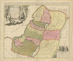
Judaea or Terra Sancta, Twelve Tribes of Israel – Sanson Map, c.1680

$935.94
£692.41
€790VAT Included
CA$1,295.38
A$1,299.91
CHF 758.12
MX$15,805.34
NOK 8,711.60
SEK 8,959.44
DKK 6,023.78

About the Item

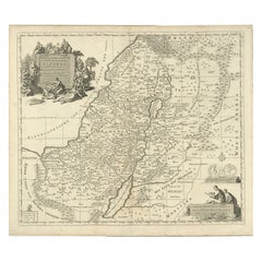
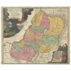
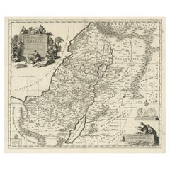
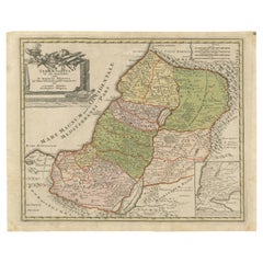
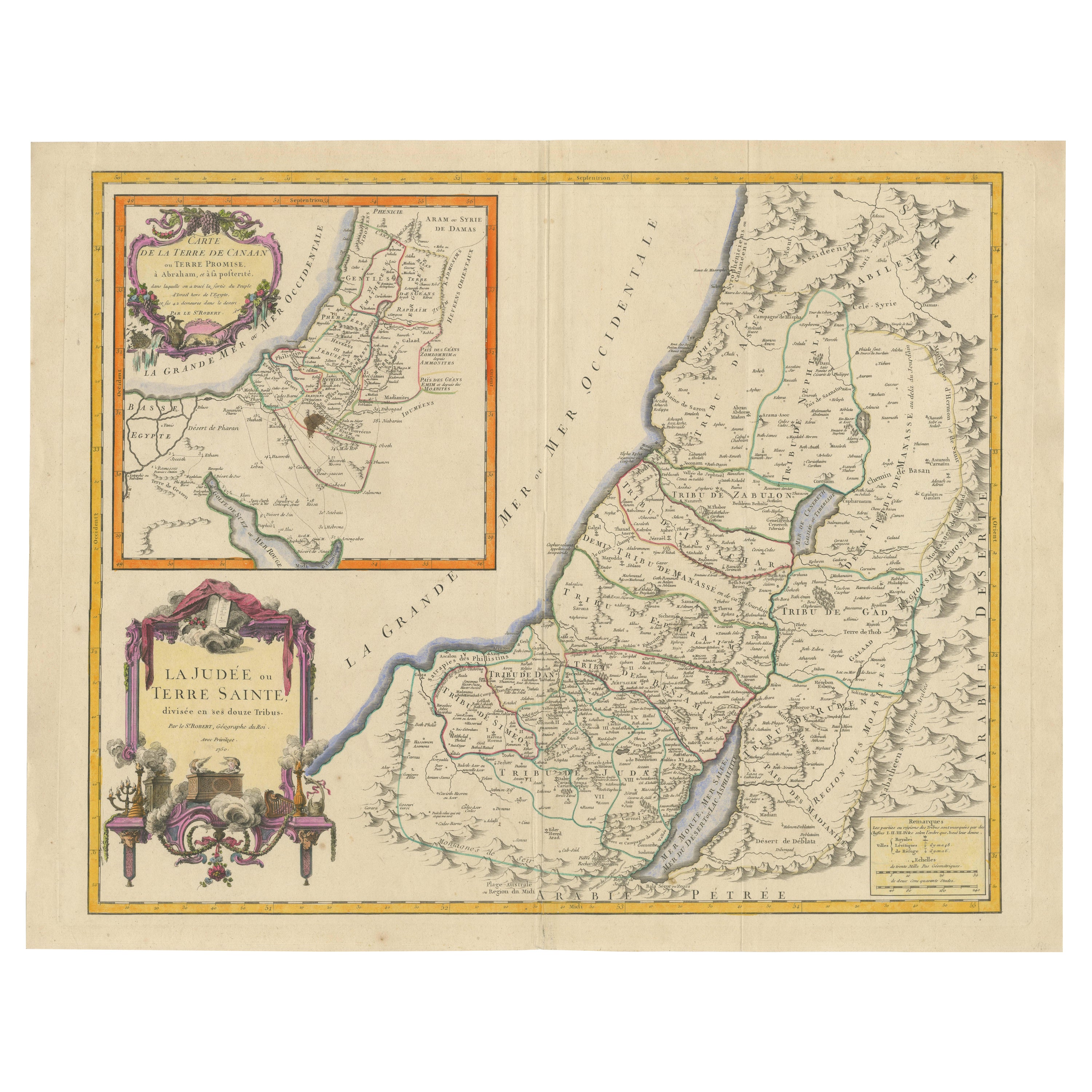
Judaea or Terra Sancta, Twelve Tribes of Israel – Sanson Map, c.1680 This antique map depicts Judaea or the Holy Land divided among the Twelve Tribes of Israel, based on biblical geography as described in the Old Testament. Titled Judæa seu Terra Sancta quæ Hebræorum sive Israelitarum Terra, in suas duodecim tribus divisa, the map presents the tribal territories both west and east of the River Jordan, including Judah, Benjamin, Simeon, Ephraim, Manasseh, Issachar, Zebulon, Asher, Naphtali, Reuben, and Gad. Major cities, deserts, mountain ranges, and waterways are carefully delineated, with the Dead Sea, River Jordan, and Mediterranean coast prominently shown. The map was engraved after the work of Guillaume Sanson (1633–1703), son of Nicolas Sanson, the founder of French scientific cartography. This example was issued in Amsterdam around 1680, reflecting the continued popularity of Sanson’s biblical cartography in the Dutch Republic. The geography follows biblical tradition rather than modern surveying, emphasizing scriptural divisions and historical interpretation. Decoratively, the map is distinguished by a large allegorical cartouche in the upper left, featuring classical figures presenting the title within drapery, as well as an additional decorative vignette in the lower right. The map is finely engraved on copper and finished with contemporary wash coloring to differentiate the tribal boundaries, lending both clarity and visual appeal. The combination of detailed engraving, rich iconography, and restrained coloring makes this an attractive example of late 17th-century Holy Land cartography. This map is well suited to collectors of early biblical maps, Sanson family cartography, or 17th-century engraved maps of the Holy Land. It also works well as a decorative interior piece, particularly in a study, library, or gallery setting. Condition: Fair to good condition. Engraved map with original horizontal and vertical folds as issued. Occasional marginal closed tears, some light creasing, and general age-related toning. No major loss to the engraved image. Framing tips: This map frames well with a warm off-white or light parchment mat to complement the period paper tone. A dark wood or gilt frame enhances the allegorical cartouche and reinforces the late 17th-century character. UV-protective glazing is recommended. Technique: Copper engraving with contemporary wash coloring Maker: Guillaume Sanson, Amsterdam, circa 1680
  • Dimensions:
    Height: 19.1 in (48.5 cm)Width: 22.84 in (58 cm)Depth: 0.01 in (0.2 mm)
  • Materials and Techniques:
    Paper,Engraved
  • Place of Origin:
  • Period:
    Late 17th Century
  • Date of Manufacture:
    circa 1680
  • Condition:
    Fair to good condition. Engraved map with original horizontal and vertical folds as issued. Occasional marginal closed tears, some light creasing, and general age-related toning. No major loss to the engraved image.
  • Seller Location:
    Langweer, NL
  • Reference Number:
    Seller: BG-14153-11stDibs: LU3054348101662

More From This Seller

View All
Sanson & Schenk Biblical Map of the Twelve Tribes of Israel, circa 1700

Sanson & Schenk Biblical Map of the Twelve Tribes of Israel, circa 1700

Located in Langweer, NL

Sanson & Schenk Biblical Map of the Twelve Tribes of Israel, circa 1700 A beautifully engraved and richly detailed antique map of the Holy Land and the Twelve Tribes of Israel, orig...

Category

Antique Early 18th Century British Maps

Materials

Paper

Antique Holy Land Map, Twelve Tribes of Israel – Covens & Mortier, c.1700

Antique Holy Land Map, Twelve Tribes of Israel – Covens & Mortier, c.1700

Located in Langweer, NL

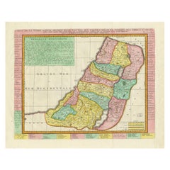
Antique Holy Land Map, Twelve Tribes of Israel – Covens & Mortier, c.1700 Description: This finely engraved early 18th-century map depicts the Holy Land divided according to the...

Category

Antique Early 18th Century French Maps

Materials

Paper

Hand-Colored Map of the Holy Land Divided Among the Twelve Tribes, c.1720

Hand-Colored Map of the Holy Land Divided Among the Twelve Tribes, c.1720

Located in Langweer, NL

Hand-Colored Map of the Holy Land Divided Among the Twelve Tribes, c.1720 This striking antique map, titled "Iudaea seu Palaestina ob Sacratissima Redemtoris Vestigia Hodie Dicta Te...

Category

Antique Early 18th Century German Maps

Materials

Paper

1718 Holy Land Map - Twelve Tribes, Six Provinces, Hand-Colored, Antique Map

1718 Holy Land Map - Twelve Tribes, Six Provinces, Hand-Colored, Antique Map

Located in Langweer, NL

Title: Terra Sancta in XII olim Tribus nunc VI Provincias Dispertita Cartographer: Christoph Weigel the Elder (1654–1725) Publisher: Johann Ernst Adelbulner Publication Locatio...

Category

Antique 1710s German Maps

Materials

Paper

1732 Henri Chatelain Map of the Holy Land Divided Among the Tribes of Israel

1732 Henri Chatelain Map of the Holy Land Divided Among the Tribes of Israel

Located in Langweer, NL

Title: 1732 Henri Chatelain Map of the Holy Land Divided Among the Tribes of Israel This exquisite 18th-century map by Henri Chatelain, published in 1732, offers a detailed depict...

Category

Antique 1710s Maps

Materials

Paper

You May Also Like

"Nova Barbariae Descriptio", a 17th Century Hand-Colored Map of North Africa

"Nova Barbariae Descriptio", a 17th Century Hand-Colored Map of North Africa

By Johannes Janssonius

Located in Alamo, CA

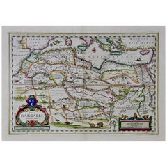
This original attractive 17th century hand-colored map of North Africa entitled "Nova Barbariae Descriptio" by Johannes Janssonius was published in Paris in 1635. It includes the Med...

Category

Antique Mid-17th Century Dutch Maps

Materials

Paper

Southern Greece: A Large 17th C. Hand-colored Map by Sanson and Jaillot

Southern Greece: A Large 17th C. Hand-colored Map by Sanson and Jaillot

By Nicolas Sanson

Located in Alamo, CA

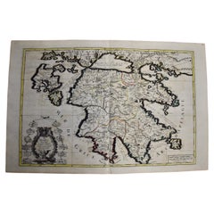
This large original hand-colored copperplate engraved map of southern Greece and the Pelopponese Peninsula entitled "La Moree Et Les Isles De Zante, Cefalonie, Ste. Marie, Cerigo & C...

Category

Antique 1690s French Maps

Materials

Paper

Map of the Kingdom of Sardinia and Part of the Kingdom of Genoa, Rome

Map of the Kingdom of Sardinia and Part of the Kingdom of Genoa, Rome

By Giovanni Maria Cassini

Located in Hamilton, Ontario

18th century map by Italian engraver Giovanni Maria Cassini (Italy 1745-1824). Map of Part of the Kingdom of Sardinia and Part of the Kingdom of Genoa: Rome. This is a hand colored a...

Category

Antique 18th Century Italian Maps

Materials

Paper

"Africa Vetus": a 17th Century Hand-Colored Map by Sanson

"Africa Vetus": a 17th Century Hand-Colored Map by Sanson

By Nicolas Sanson

Located in Alamo, CA

This original hand-colored copperplate engraved map of Africa entitled "Africa Vetus, Nicolai Sanson Christianiss Galliar Regis Geographi" was originally created by Nicholas Sanson d...

Category

Antique Late 17th Century French Maps

Materials

Paper

Africa: A Large 17th Century Hand-Colored Map by Sanson and Jaillot

Africa: A Large 17th Century Hand-Colored Map by Sanson and Jaillot

By Nicolas Sanson

Located in Alamo, CA

This large original hand-colored copperplate engraved map of Africa entitled "L'Afrique divisee suivant l'estendue de ses principales parties ou sont distingues les uns des autres, L...

Category

Antique 1690s French Maps

Materials

Paper

Map Holy Land La Terre Sainte Engraved van Loon Published N de Fer 1703 French

Map Holy Land La Terre Sainte Engraved van Loon Published N de Fer 1703 French

Located in BUNGAY, SUFFOLK

La Terre Sainte, The Holy Land, Tiree Des Memoires De M.De.La Rue. Par N. de Fer. Geographe de Sa Majeste Catoliq et de Monseigneur le Dauphin. Avec Privil du Roi 1703 Detailed map of the Holy Land from Nicholas de Fer's L'Atlas Curieux ou le Monde. East is oriented at the top. MAKER Nicolas de Fer 1646-1720 The French cartographer and engraver, Nicolas de Fer, was a master at creating maps that were works of art. The maps that he published were printed during the Baroque period when the decorative arts were characterized by ornate detail. De Fer’s detailed maps and atlases were valued more for their decorative content than their geographical accuracy. Nicolas de Fer was born in 1646. His father, Antoine de Fer, owned a mapmaking firm. At the age of twelve, Nicolas was apprenticed to a Parisian engraver named Louis Spirinx. The family business was starting to decline when his father died in 1673. Nicolas de Fer’s mother, Genevieve, took over the business after the death of her husband. In 1687 the business was passed on to Nicolas and the profits increased after he took over the firm. Nicolas de Fer was a prolific cartographer who produced atlases and hundreds of single maps. He eventually became the official geographer to King Louis XIV of France and King Philip V...

Category

Antique Early 1700s French Louis XIV Maps

Materials

Paper