Want more images or videos?
Request additional images or videos from the seller
1 of 7

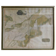
1796 Map of North Carolina by John Reid

$1,500List Price

You May Also Like

Antique Map Southern United States — Carolina & Georgia, Bonne c.1780

Antique Map Southern United States — Carolina & Georgia, Bonne c.1780

Located in Langweer, NL

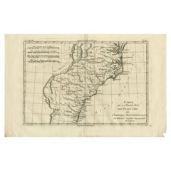
Antique Map Southern United States — Carolina & Georgia, Bonne c.1780 This finely engraved eighteenth-century map by Rigobert Bonne depicts the southern portion of the early United States, focusing on the Carolinas, Georgia, and adjacent southeastern territories during the Enlightenment era. Engraved circa 1780, the map reflects Bonne’s influential position as Ingénieur-Hydrographe de la Marine and chief cartographer at the Dépôt de la Marine in Paris, where he succeeded Jacques-Nicolas Bellin and helped redefine European cartography through clarity, scientific precision, and systematic geographic representation. Titled “Carte de la Partie Sud des États Unis de l’Amérique Septentrionale,” the composition illustrates the southeastern Atlantic seaboard, extending from Virginia southward through North Carolina, South Carolina, and Georgia. Coastal features, navigational inlets, and maritime approaches are carefully delineated, highlighting the strategic importance of this region for colonial trade and naval activity. Major settlements, rivers, and geographic features appear throughout, alongside references to indigenous territories and frontier regions, reflecting contemporary European geographic knowledge in the years surrounding the American Revolution. Bonne’s engraving style emphasizes clarity and balance rather than decorative excess. Delicate linework and restrained hachuring suggest terrain, while the structured grid system reinforces scientific accuracy and legibility. Coastal bays, barrier islands, and river systems are rendered with precision, underscoring the maritime orientation of Enlightenment cartography and the importance of accurate coastal charts for navigation and colonial administration. Produced during a transformative period in North American history, this map offers insight into how European cartographers interpreted the newly emerging United States and its southern frontier. As part of Bonne’s mature output, it combines scholarly significance with strong decorative appeal, making it desirable both for collectors of early American cartography and for refined interior display. Condition report: Good antique condition with age-related toning, visible central fold as issued, light scattered spotting, and minor handling wear consistent with eighteenth-century paper; margins remain suitable for framing. Framing tips: Particularly effective in a dark walnut or black frame with an ivory or warm off-white mat; the wide horizontal format works well above desks or consoles and pairs nicely with related Bonne maps of North America for a cohesive historical presentation. Technique: Copperplate engraving Maker: Rigobert Bonne, France, circa 1780 Keyword block: Southern United States antique map, Carolina Georgia antique map, Rigobert Bonne map, early USA cartography, Enlightenment era America map, Dépôt de la Marine map, Virginia Carolina Georgia map antique, Atlantic coast historical map, American Revolution era cartography, French cartography United States, 18th century American map engraving, colonial southeastern USA map, antique nautical chart...

Category

Antique Late 18th Century French Maps

Materials

Paper

Antique 18th Century Map of the Province of Pensilvania 'Pennsylvania State'

Antique 18th Century Map of the Province of Pensilvania 'Pennsylvania State'

Located in Philadelphia, PA

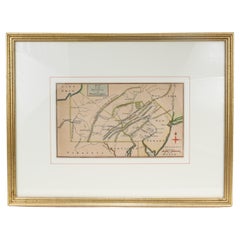
A fine antique of the colony of Pennsylvania. Noted at the top of the sheet as a 'Map of the province of Pensilvania'. This undated and anonymous map is thought to be from the Gentleman's Magazine, London, circa 1775, although the general appearance could date it to the 1760's. The southern boundary reflects the Mason-Dixon survey (1768), the western boundary is placed just west of Pittsburgh, and the northern boundary is not marked. The map has a number of reference points that likely refer to companion text and appear to be connected to boundaries. The western and southern boundaries are marked Q, R, S, for example. A diagonal line runs from the Susquehanna R to the Lake Erie P. A broken line marked by many letters A, B, N, O, etc., appears in the east. There are no latitude or longitude markings, blank verso. Framed in a shaped contemporary gilt wooden frame and matted under a cream colored matte. Bearing an old Graham Arader Gallery...

Category

Antique 18th Century British American Colonial Maps

Materials

Paper

1812 "United States of North America" Two-Sheet Map by Pierre François Tardieu

1812 "United States of North America" Two-Sheet Map by Pierre François Tardieu

By Pierre François Tardieu

Located in Colorado Springs, CO

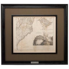
1812 "United States of Nth America -- Carte des Etats-Unis De L'Amerique Septentrionale" Two-Sheet Map by Tardieu This attractive map, published in Paris in 1812, is one of the most rare large format maps from the period. It features a view of the East Coast of the U.S. from Maryland to just below South Carolina. Additionally, Ellicott’s plan for the City of Washington D.C. is included at the top right and an illustration of Niagara Falls is shown at the bottom right with a description in both French and English. This extremely detailed map not only depicts the mountainous regions of the southeastern U.S., but also includes names of regions, rivers, and towns. Based on the first state of Arrowsmith’s 4-sheet map of the United States, this map is completely engraved by Tardieu in Paris and showcases high quality engravings. This detailed map of the recently independent United States includes one of the largest and earliest examples of the Ellicott plan of Washington DC. The artist, Pierre François Tardieu (PF Tardieu) was a very well-known map engraver, geographer, and illustrator. Awarded a bronze medal by King Louis-Phillipe for the accuracy and beauty of his map-making, Tardieu produced many fine works including maps of Louisiana...

Category

Antique 1810s French Maps

Materials

Paper

1807 "A Map of the Country..." by Samuel Lewis, Revolutionary War Map

1807 "A Map of the Country..." by Samuel Lewis, Revolutionary War Map

Located in Colorado Springs, CO

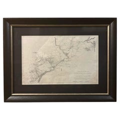
Presented is “A Map of the Country from Rariton River in East Jersey to Elk Head in Maryland, Shewing the several Operations of the American and British Armies, in 1776 & 1777.”  The...

Category

Antique Early 1800s American Federal Maps

Materials

Paper

Von Reilly Map of the Russian Empire, 1796

Von Reilly Map of the Russian Empire, 1796

$1,200

H 24.5 in W 32 in D 0.75 in

Von Reilly Map of the Russian Empire, 1796

Located in Savannah, GA

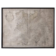
A map of the Russian Empire in Europe by Von Reilly. Published in Vienna, 1796. 32 inches wide by 24 ½ inches tall

Category

Antique 1790s Austrian Prints

Materials

Glass, Wood, Paper

English Engraved Hand Colored Map of the North Eastern United States, circa 1817

English Engraved Hand Colored Map of the North Eastern United States, circa 1817

Located in Charleston, SC

English copper engraved hand colored map of the North Eastern United States matted under glass in a gilt frame, Early 19th Century. Drawn and Engraved for Thomson's New General Atlas...

Category

Antique 1810s English George III Maps

Materials

Glass, Giltwood, Paint, Paper

Antique Map of the United States of North America by Wyld '1845'

Antique Map of the United States of North America by Wyld '1845'

$235Sale Price|20% Off

H 10.24 in W 14.18 in D 0.02 in

Antique Map of the United States of North America by Wyld '1845'

Located in Langweer, NL

Antique map titled 'Map of The United States of North America'. Original antique map of the United States of North America. This map originates from 'An Atlas of the World, Comprehen...

Category

Antique Mid-19th Century Maps

Materials

Paper

Antique Lithography Map, Cumberland, English, Framed, Cartography, Victorian

Antique Lithography Map, Cumberland, English, Framed, Cartography, Victorian

$562Sale Price|20% Off

H 15.95 in W 13.19 in D 0.6 in

Antique Lithography Map, Cumberland, English, Framed, Cartography, Victorian

Located in Hele, Devon, GB

This is an antique lithography map of Cumberland. An English, framed atlas engraving of cartographic interest, dating to the mid 19th century and la...

Category

Antique Mid-19th Century British Victorian Maps

Materials

Wood

Antique County Map, Surrey, English, Framed Lithograph, Cartography, Victorian

Antique County Map, Surrey, English, Framed Lithograph, Cartography, Victorian

$562Sale Price|20% Off

H 13.78 in W 15.95 in D 0.6 in

Antique County Map, Surrey, English, Framed Lithograph, Cartography, Victorian

Located in Hele, Devon, GB

This is an antique lithography map of Surrey. An English, framed atlas engraving of cartographic interest, dating to the mid 19th century and later. Superb lithography of Surrey an...

Category

Antique Mid-19th Century British Victorian Maps

Materials

Paper

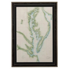
1856 U.S. Coast Survey Map of Chesapeake Bay and Delaware Bay

1856 U.S. Coast Survey Map of Chesapeake Bay and Delaware Bay

Located in Colorado Springs, CO

Presented is U.S. Coast Survey nautical chart or maritime map of Chesapeake Bay and Delaware Bay from 1856. The map depicts the region from Susquehanna, Maryland to the northern Outer Banks in North Carolina. It also shows from Richmond and Petersburg, Virginia to the Atlantic Ocean. The map is highly detailed with many cities and towns labeled throughout. Rivers, inlets, and bays are also labeled. Various charts illustrating more specific parts of the region are marked on the map using dotted lines. The lines form boxes, and the corresponding chart number and publication date are given. Extensive triangulation surveys were conducted the length of Chesapeake Bay and are illustrated here. Hampton Roads, Virginia is labeled, along with the James, York, and Rappahannock Rivers, which were all extensively surveyed. The chart was published under the supervision of A. D. Bache, one of the most influential and prolific figures in the early history of the U.S. Coast Survey, for the 1856 Report of the Superintendent of the U.S. Coast Survey. Alexander Dallas Bache (1806-1867) was an American physicist, scientist, and surveyor. Bache served as the Superintendent of the U.S. Coast Survey from 1843 to 1865. Born in Philadelphia, Bache toured Europe and composed an important treatise on European Education. He also served as president of Philadelphia's Central High School and was a professor of natural history and chemistry at the University of Pennsylvania. Upon the death of Ferdinand Rudolph Hassler, Bache was appointed Superintendent of the United States Coast Survey. The Office of the Coast Survey, founded in 1807 by President Thomas Jefferson and Secretary of Commerce Albert Gallatin...

Category

Antique 1850s American Maps

Materials

Paper

More From This Seller

View All
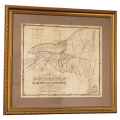
1851 American Framed Original Iroquois Nation Map by Lewis Henry Morgan

1851 American Framed Original Iroquois Nation Map by Lewis Henry Morgan

Located in Chapel Hill, NC

Framed original 1851 Iroquois Nation Map by Lewis Henry Morgan. Titled: "Map of Ho-de-no-sau-nee-ga, or the Territories of the People of the Long House in 1720". It is one of the mos...

Category

Antique Mid-19th Century American Victorian Maps

Materials

Glass, Wood, Paper

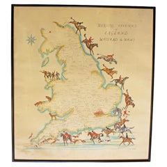
Hunting Counties of England, Scotland & Wales Map by B.C. Moore

Hunting Counties of England, Scotland & Wales Map by B.C. Moore

Located in Chapel Hill, NC

Hunting Counties of England, Scotland & Wales map artist signed, England. Hand colored borders & colorful riders to the hounds. Artist signed lower right B.C. Moore & monogrammed in ...

Category

20th Century English Sporting Art Decorative Art

Materials

Paper

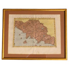
1562 Map of Toscana Nuova Tavola by Girolamo Ruscelli

1562 Map of Toscana Nuova Tavola by Girolamo Ruscelli

Located in Chapel Hill, NC

A 1562 map of Toscana Nuova Tavola by Girolamo Ruscelli. Tuscany is the heart of Italy & birthplace of the Italian language. Early hand-coloring. Copper plate engraving. Interestingl...

Category

Antique 16th Century Italian Renaissance Maps

Materials

Paper

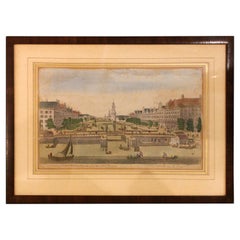
1752 "A View of Amsterdam" Print From George Balthasar Probst Lithograph

1752 "A View of Amsterdam" Print From George Balthasar Probst Lithograph

By Georg Balthasar Probst

Located in Chapel Hill, NC

A View of Amsterdam taken from the Old Rampart print published April 10, 1752, English. Published according to Act of Parliament. Old hand coloring. From the George Balthasar Probst ...

Category

Antique Mid-18th Century English Neoclassical Prints

Materials

Paper

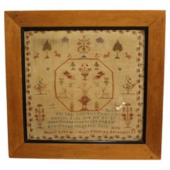
1820 Large Framed English Needlework by Mary Leak

1820 Large Framed English Needlework by Mary Leak

Located in Chapel Hill, NC

1820 Large Framed English Sampler by Mary Leak. A naively yet grandly conceived work of flowers, trees, animals & a verse of warning. The central 8-sid...

Category

Antique 1820s English George IV Tapestries

Materials

Fabric

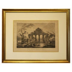
Late 18th Century French Print "Temple Herastyle Périptère de Pestum"

Late 18th Century French Print "Temple Herastyle Périptère de Pestum"

Located in Chapel Hill, NC

Late 18th century print "Temple Herastyle Périptère de Pestum", French. No 381, G.G., Gravé à L'eau-forte par Weisbret. Terminé par J. Miamet graveur du Roi. From "Voyage Pittoresque...

Category

Antique Late 18th Century French Neoclassical Prints

Materials

Paper