Want more images or videos?
Request additional images or videos from the seller
1 of 7

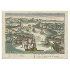
Dardanelles Strait, with a Perspective of the City of Constantinople, 1693

$323.51
$404.3820% Off
£237.37
£296.7120% Off
€272VAT Included
€34020% Off
CA$448.17
CA$560.2220% Off
A$452.40
A$565.4920% Off
CHF 259.95
CHF 324.9320% Off
MX$5,483.58
MX$6,854.4720% Off
NOK 3,008.76
NOK 3,760.9520% Off
SEK 3,073.28
SEK 3,841.6020% Off
DKK 2,073.94
DKK 2,592.4320% Off

About the Item

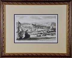
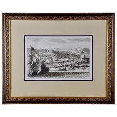
Title: "Veue des Dardanelles de Constantinople, 1693" Description: This historical copper engraving, crafted by Nicholas de Fer between 1646 and 1720 in Paris, is a remarkable depiction titled "Veue des Dardanelles de Constantinople." It was included in de Fer's esteemed collection, "Les Forces de l'Europe," published in 1693. The detailed artwork offers a panoramic view of the strategic Dardanelles Strait, with a distant perspective of the city of Constantinople (modern-day Istanbul) in the backdrop. The engraving not only captures the strategic importance of the Dardanelles, historically known as the Hellespont, but also serves as a valuable cartographic document of the era, showcasing the military and maritime strength of the region during the late 17th century.
  • Dimensions:
    Height: 10.56 in (26.8 cm)Width: 15.75 in (40 cm)Depth: 0 in (0.02 mm)
  • Materials and Techniques:
    Paper,Engraved
  • Period:
    1690-1699
  • Date of Manufacture:
    1693
  • Condition:
    Good. Engraving on hand laid (verge) paper with original watermark. General age-related toning and/or occasional minor defects from handling. Please study scan carefully.
  • Seller Location:
    Langweer, NL
  • Reference Number:
    Seller: BG-137291stDibs: LU3054338822542

More From This Seller

View All
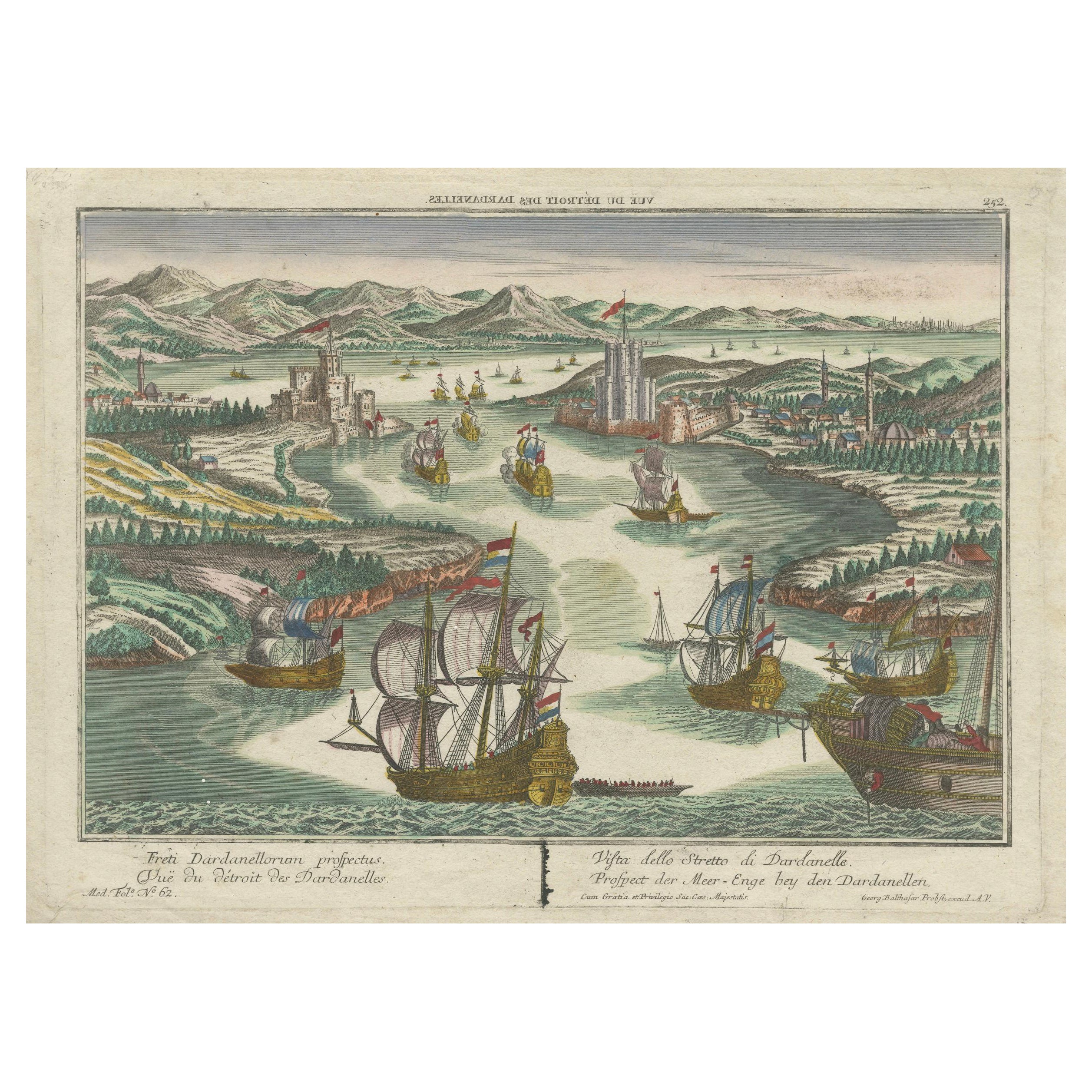
Dardanelles Strait, Ottoman Turkey – Probst Optical View with Ships, c.1770

Dardanelles Strait, Ottoman Turkey – Probst Optical View with Ships, c.1770

Located in Langweer, NL

Dardanelles Strait, Ottoman Turkey – Probst Optical View with Ships, c.1770 This highly decorative hand-colored optical view depicts the Strait of the Dardanelles (Çanakkale Boğazı)...

Category

Antique 1770s German Prints

Materials

Paper

Engraved View of the Dardanelles with Fortifications and Ships, ca. 1680

Engraved View of the Dardanelles with Fortifications and Ships, ca. 1680

Located in Langweer, NL

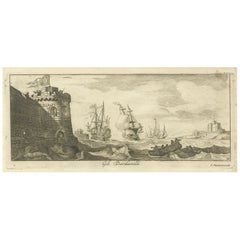
Title: View of the Dardanelles with Fortifications and Ships, ca. 1680 Description: This copperplate engraving offers a detailed view of the Dardanelles Strait, emphasizing its s...

Category

Antique 1680s Prints

Materials

Paper

View of Bartanico in the Aegean Archipelago with Fortifications and Ships, 1680

View of Bartanico in the Aegean Archipelago with Fortifications and Ships, 1680

Located in Langweer, NL

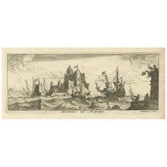
Title: View of Bartanico in the Aegean Archipelago with Fortifications and Ships, ca. 1680 Description: This copperplate engraving depicts a striking view of Bartanico (possibly P...

Category

Antique 1680s Prints

Materials

Paper

The Dardanelles in the Age of Sail: A Panoramic Etching, Ca.1765

The Dardanelles in the Age of Sail: A Panoramic Etching, Ca.1765

Located in Langweer, NL

This rare and exquisite view depicts the strategic Dardanelles strait, the narrow passage between the Aegean and the Sea of Marmara with the distant cityscape of Istanbul. Part of th...

Category

Antique 1760s Prints

Materials

Paper

View of Fanar in the Aegean Archipelago with Bridge and Ships, ca. 1680

View of Fanar in the Aegean Archipelago with Bridge and Ships, ca. 1680

Located in Langweer, NL

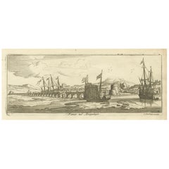
Title: View of Fanar in the Aegean Archipelago with Bridge and Ships, ca. 1680 Description: This copperplate engraving showcases a detailed view of Fanar (possibly Fener or anothe...

Category

Antique 1680s Prints

Materials

Paper

You May Also Like

18th Century French Map and City View of Joppe/Jaffa (Tel Aviv) by Sanson

18th Century French Map and City View of Joppe/Jaffa (Tel Aviv) by Sanson

By Nicholas Sanson d'Abbeville

Located in Alamo, CA

An original antique engraving entitled "Joppe; in ’t Hebreeusch by ouds Japho; hedendaags Japha, of Jaffa; volgens d’aftekening gedaan 1668", by Nicholas Sanson d'Abbeville (1600 - 1667). This is a view of the city of Joppe (in Hebrew Japho), now called Japha or Jaffa, the harbor portion of modern day Tel Aviv, Israel as it appeared in 1668 . It depicts a very busy harbor with numerous boats. A large ship on the left appears to be firing its canons and a small ship on the right appears to be sitting very low in the water, either heavily loaded with cargo or sinking. The town is seen on the far shore with a fortress on a hill across in the background. The map is printed from the original Sanson copperplate and was published in 1709 by his descendants. The map is presented in an ornate brown wood frame embellished by gold-colored leaves and gold inner trim with a double mat; the outer mat is cream-colored and the inner mat is black. There is a central vertical fold, as issued. There are two small spots in the lower margin and one in the upper margin, as well as two tiny spots adjacent to the central fold. 1717 is written below the date 1668 in the inscription. The map is otherwise in very good condition. Another map of the "Holy Land" (by Claes Visscher in 1663), with an identical style frame and mat is available. This pair of maps would make a wonderful display grouping. Please see Reference #LU117324709892. Artist: Nicholas Sanson d'Abbeville (1600 - 1667) and his descendents were important French cartographer's active through the 17th century. Sanson started his career as a historian and initially utilized cartography to illustrate his historical treatises. His maps came to the attention of Cardinal Richelieu and then King Louis XIII of France, who became a supporter and sponsor. He subsequently appointed Sanson 'Geographe Ordinaire du Roi' the official map maker to the king. Sanson not only created maps for the king, but advised him on geographical issues and curated his map collection...

Category

Early 1700s Prints and Multiples
Materials

Engraving

Copperplate Engraving of the Port of Lima from 1671 by Jacob van Meurs

Copperplate Engraving of the Port of Lima from 1671 by Jacob van Meurs

By Jacob van Meurs

Located in Brooklyn, NY

Part of the masterwork of Dutch theologian, explorer, and missionary Arnoldus Mantanus De Nieuwe en Onbekende Weereld from 1671, this theatrical scene of the Port of Lima displays a bustling Harbour full of masted ships. One of the richest cities of the New World, Lima became the capital of the largest colonial viceroyalty of the Spanish crown...

Category

Antique 1670s Dutch Baroque Prints

Materials

Paper

18th Century French Map and City View of Joppe/Jaffa 'Tel Aviv' by Sanson

18th Century French Map and City View of Joppe/Jaffa 'Tel Aviv' by Sanson

By Nicolas Sanson

Located in Alamo, CA

An original antique engraving entitled "Joppe; in ’t Hebreeusch by ouds Japho; hedendaags Japha, of Jaffa; volgens d’aftekening gedaan 1668", by Nicholas Sanson d'Abbeville (1600 - 1667). This is a view of the city of Joppe (in Hebrew Japho), now called Japha or Jaffa, the harbor portion of modern day Tel Aviv, Israel as it appeared in 1668 . It depicts a very busy harbor with numerous boats. A large ship on the left appears to be firing its canons and a small ship on the right appears to be sitting very low in the water, either heavily loaded with cargo or sinking. The town is seen on the far shore with a fortress on a hill across in the background. The map is printed from the original Sanson copperplate and was published in 1709 by his descendants. The map is presented in an ornate brown wood frame embellished by gold-colored leaves and gold inner trim with a double mat; the outer mat is cream-colored and the inner mat is black. There is a central vertical fold, as issued. There are two small spots in the lower margin and one in the upper margin, as well as two tiny spots adjacent to the central fold. 1717 is written below the date 1668 in the inscription. The map is otherwise in very good condition. Another map of the "Holy Land" (by Claes Visscher in 1663), with an identical style frame and mat is available. This pair of maps would make a wonderful display grouping. Please see Reference #LU5206220653552. A discount is available for the purchase of the pair of maps. Artist: Nicholas Sanson d'Abbeville (1600-1667) and his descendents were important French cartographer's active through the 17th century. Sanson started his career as a historian and initially utilized cartography to illustrate his historical treatises. His maps came to the attention of Cardinal Richelieu and then King Louis XIII of France, who became a supporter and sponsor. He subsequently appointed Sanson 'Geographe Ordinaire du Roi' the official map maker to the king. Sanson not only created maps for the king, but advised him on geographical issues and curated his map collection...

Category

Antique Early 18th Century French Maps

Materials

Paper

A View of Cape Rouge, Quebec, Canada, Mazell after Capt. Hervey Smyth, c.1760s

A View of Cape Rouge, Quebec, Canada, Mazell after Capt. Hervey Smyth, c.1760s

Located in Savannah, GA

A View of Cape Rouge, or Carouge, on the Saint Lawrence River, north of Quebec. Engraving by Peter Mazell after a drawing by Captian Hervey Smyth, published c.1760's, London. T...

Category

Antique 1760s Canadian British Colonial Prints

Materials

Paper