Want more images or videos?
Request additional images or videos from the seller
1 of 9

Ancient Syria Map Including Palestine, Jerusalem & Mount Sinai, 1843

$633.78
£468.87
€535VAT Included
CA$877.18
A$880.37
CHF 513.37
MX$10,702.70
NOK 5,899.12
SEK 6,066.95
DKK 4,079.04

About the Item

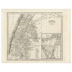
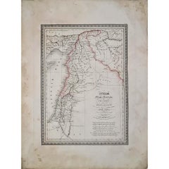
Ancient Syria Map Including Palestine, Jerusalem & Mount Sinai, 1843 A highly detailed and historically evocative antique map titled “Ancient Syria,” published in London in 1843 under the supervision of the Society for the Diffusion of Useful Knowledge. This finely engraved map presents the geography of the ancient Levant, extending from Cappadocia and Antioch in the north through Phoenicia, Palestine, and Judea to the Sinai Peninsula and the northern reaches of Arabia. The map was drawn by the classical scholar and historian Major Rennell and reflects the scholarly interest in biblical and classical geography that flourished during the early nineteenth century. Executed with exceptional delicacy, the engraving combines subtle topographical shading with sparse original outline hand coloring, creating an elegant academic aesthetic highly characteristic of the finest early SDUK productions. Particularly striking is the elongated depiction of the Holy Land and eastern Mediterranean coast, identifying important biblical and classical sites including Jerusalem, Bethlehem, Jericho, Nazareth, Hebron, Tyre, Sidon, Damascus, Antioch, and the Jordan River. The inset map at lower right focuses on Mount Sinai and the wanderings of the Israelites, greatly enhancing the historical and biblical significance of the sheet. Caravan routes, ancient territorial boundaries, rivers, mountain ranges, and desert regions are carefully engraved throughout. The restrained visual style and expansive open spaces give the composition a refined decorative quality highly suited for framing. This map appeals strongly to collectors interested in biblical history, the Holy Land, early Middle Eastern cartography, classical antiquity, and nineteenth-century educational atlases. The combination of Palestine, Jerusalem, and Mount Sinai within one composition makes it especially desirable for both historical and decorative purposes. This piece displays beautifully in a dark walnut, ebonized, or gilt frame with a wide ivory mat, particularly in studies, libraries, or interiors inspired by travel, archaeology, or Near Eastern history. Condition: Good antique condition with age-related toning and occasional light foxing. Minor handling wear and faint discoloration consistent with age. Wide margins preserved. Please study image carefully. Special note: This is an original antique engraving, not a reproduction. All items we offer are authentic period works of art over 100 years old. The piece is sold unframed; any framed images are shown for presentation and interior inspiration only and may not always be to scale. Keywords: Ancient Syria map, Palestine map, Holy Land map, Jerusalem map, Mount Sinai map, biblical map, Judea, Phoenicia, Antioch, Damascus, Bethlehem, Nazareth, Jordan River, Dead Sea, Levant map, ancient Near East, biblical geography, SDUK map, Rennell map, classical antiquity, Holy Land cartography, Sinai Peninsula, antique Middle East map, Jerusalem antique map, 19th century engraving Technique: Steel engraving with original outline hand color Maker: Society for the Diffusion of Useful Knowledge, London, 1843
  • Dimensions:
    Height: 16.15 in (41 cm)Width: 13.59 in (34.5 cm)Depth: 0.01 in (0.2 mm)
  • Materials and Techniques:
    Paper,Engraved
  • Place of Origin:
  • Period:
  • Date of Manufacture:
    1843
  • Condition:
    Good antique condition with age-related toning and occasional light foxing. Minor handling wear and faint discoloration consistent with age. Wide margins preserved. Please study image carefully.
  • Seller Location:
    Langweer, NL
  • Reference Number:
    Seller: BG-14279-661stDibs: LU3054350002912

More From This Seller

View All
Antique Map of Southern Syria by Fullarton & Co, circa 1860

Antique Map of Southern Syria by Fullarton & Co, circa 1860

Located in Langweer, NL

Antique map titled 'Syria south part'. Published by Fullarton & Co, Glasgow, circa 1860. - Title: Syria South Part - Publisher: Fullarton & Co, Glasgow - Date of Publication: Circa ...

Category

Antique Mid-19th Century English Maps

Materials

Paper

Antique Map of Palestine and the Holy Land – Lapie, Paris, 1838

Antique Map of Palestine and the Holy Land – Lapie, Paris, 1838

Located in Langweer, NL

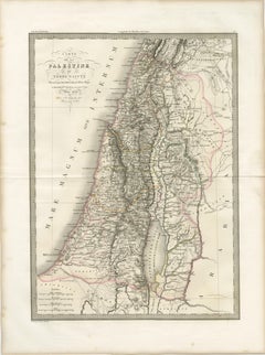

Antique Map of Palestine and the Holy Land – Lapie, Paris, 1838 This elegant and finely engraved map of Palestine, titled Carte de la Palestine ou Terre Sainte, was published in Paris in 1838 as part of the celebrated Atlas Universel de Géographie Ancienne et Moderne by the distinguished French cartographer M. Lapie. It presents a detailed and scholarly depiction of the Holy Land, a region of profound historical, religious, and cultural significance. The map encompasses the eastern Mediterranean coastline, extending inland across the varied topography of Palestine and surrounding regions. The Dead Sea (Lac Asphaltite) is prominently depicted, along with the Jordan River running north to south, anchoring the composition both geographically and visually. Major biblical and historical locations—such as Jerusalem, Jericho, Bethlehem, Nazareth, and Hebron—are carefully marked, reflecting the strong 19th-century European interest in biblical geography and pilgrimage landscapes. Lapie’s cartographic approach balances clarity with refinement. Mountain ranges are rendered with delicate hachuring, conveying the rugged terrain of the region, while subtle hand coloring distinguishes administrative or historical divisions without overwhelming the composition. The Mediterranean Sea (Mare Internum) frames the western edge, adding visual balance to the vertically oriented sheet. The engraving was executed by Pierre Antoine Tardieu, a member of the renowned Tardieu family of French engravers, known for their precision and contribution to scientific and cartographic works. His refined linework ensures exceptional readability and lends the map an understated elegance characteristic of high-quality French atlas production of the period. This map functions both as a scholarly representation of biblical lands and as a refined decorative piece. Its vertical format makes it particularly suitable for display in narrower wall spaces, such as between windows or within a gallery arrangement. It would appeal to collectors of historical cartography, as well as those with an interest in religious history and the geography of the ancient Near East. Condition: Very good condition overall. Light toning consistent with age and a central fold as issued. Margins are wide and clean. Minor spotting in places. No significant tears or restorations observed. Plate mark visible. Framing tips: This piece would display beautifully in a dark walnut or ebonized frame with a wide ivory or off-white mat, enhancing its classical and historical character. For a more contemporary look, a slim black frame with a floating mount can create a clean and sophisticated presentation. Technique: Engraving with original hand coloring Maker: M. Lapie, engraved by Pierre Antoine Tardieu, Paris, 1838 Keywords: Palestine, Holy Land, Terre Sainte, Jerusalem, Dead Sea, Jordan River, Bethlehem, Nazareth, Hebron, Jericho, biblical geography, Near East, Middle East, Levant, Mediterranean Sea, Mare Internum, ancient geography, religious maps, historical cartography, 19th century map, French cartography, Atlas Universel, Lapie map, Tardieu engraving, antique map Palestine...

Category

Antique Early 19th Century French Maps
Materials

Paper

Antique Map of Syria, Egypt and the Nile Delta – Lapie, 1838

Antique Map of Syria, Egypt and the Nile Delta – Lapie, 1838

Located in Langweer, NL

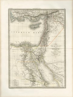

Antique Map Syria Egypt Nile Delta, Lapie 1838 – Hand Colored Engraving This finely detailed antique map of Syria and Egypt was published in Paris in 1838 as part of the celebrated ...

Category

Antique Early 19th Century French Maps
Materials

Paper

Historical Map of Canaan with Insets of Jerusalem and Surrounding Regions, 1880

Historical Map of Canaan with Insets of Jerusalem and Surrounding Regions, 1880

Located in Langweer, NL

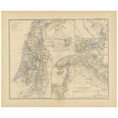
The map titled "CANAAN" depicts the historical region known as Canaan, located in the Levant, which corresponds to modern-day Israel, Palestinian territories, Lebanon, and parts of S...

Category

Antique 1880s Maps

Materials

Paper

Antique Map of the Biblical Lands, Arabia and Canaan, Malte-Brun c.1820

Antique Map of the Biblical Lands, Arabia and Canaan, Malte-Brun c.1820

Located in Langweer, NL

Antique Map of Sinai and Gulf of Suez by Niebuhr, Arabia, c.1774 A rare and highly important 18th-century engraved map titled “Tabula Itineraria a Sues usque ad Dsjaebbel el Mokatte...

Category

Antique Early 19th Century Dutch Maps

Materials

Paper

Territories of Antiquity: The Northern Division of Syria, A Detailed 1882 Map

Territories of Antiquity: The Northern Division of Syria, A Detailed 1882 Map

Located in Langweer, NL

This 19th-century map from the atlas published by Blackie and Son in 1882 is titled "SYRIA (NORTH DIVISION)" and covers the northern part of Syria, capturing its geographical and adm...

Category

Antique 1880s English Maps

Materials

Paper

You May Also Like

Original Antique Map of Egypt By J.Dower. Unframed, Circa 1835

Original Antique Map of Egypt By J.Dower. Unframed, Circa 1835

Located in St Annes, Lancashire

Great map of Egypt Drawn and engraved by J.Dower Published by Orr & Smith. C.1835 Unframed. Free shipping

Category

Antique 1830s English Maps

Materials

Paper

Large Original Antique Map of Morocco. Edward Weller, 1861

Large Original Antique Map of Morocco. Edward Weller, 1861

Located in St Annes, Lancashire

Great map of Morocco Lithograph engraving by Edward Weller Original colour Published, 1861 Unframed Good condition.    

Category

Antique 1860s English Victorian Maps

Materials

Paper