Want more images or videos?
Request additional images or videos from the seller
1 of 10

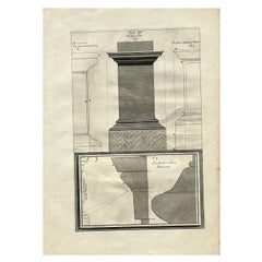
Nilometer in Cairo – Section and Plan for Measuring Nile Floods, Egypt 1776

$282.39
£209.09
€240VAT Included
CA$393.32
A$400.16
CHF 229.33
MX$4,818.13
NOK 2,680.44
SEK 2,692.20
DKK 1,830.10

About the Item

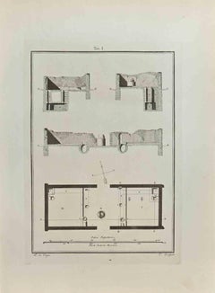
Nilometer in Cairo – Section and Plan for Measuring Nile Floods, Egypt 1776 Description: This original 1776 engraving shows a vertical section and ground plan of the Nilometer in Cairo, an ancient and historically important structure used to measure the water levels of the Nile River. The engraving is Plate XII from the Dutch edition of Richard Pococke’s travel writings and illustrates the practical architecture behind Egypt’s historical flood monitoring system. The upper portion of the engraving features a cross-section view of the Nilometer building, topped with a dome and crescent. Below the dome, a gallery with arched openings looks into a deep vertical shaft where the water level was observed. The structure includes stone walls and brick layers labeled A, and a central measurement pillar descending into the well. Below, the lower portion of the plate presents the ground plan. The square outer enclosure surrounds a smaller central structure labeled B, which aligns with the measurement shaft seen in the cross-section. This compact yet robust architecture was designed to endure the fluctuating and sometimes forceful rise of the Nile. The Dutch caption beneath the engraving reads, "De Platte Grond en doorsnêede des Mikîas te Kairo, om de hoogte des Nyls te meeten," translating to "The plan and cross-section of the Nilometer in Cairo, for measuring the height of the Nile." The Nilometer at Roda Island, one of the oldest examples, dates to the early Islamic period but is built upon even older traditions of Nile monitoring that were crucial for agriculture, taxation, and religious practice in ancient Egypt. This image is from *Beschryving van het Oosten en van eenige andere landen* (Description of the East and Some Other Lands), translated and annotated by Ernst Willem Cramerus and published in Utrecht, Rotterdam, and Amsterdam in 1776. Pococke’s work remains a significant source for 18th-century views of Middle Eastern sites. Condition report: Excellent condition. Minor age toning and a few faint margin spots. Strong plate impression with wide borders. No damage or repairs. Folding lines as issued. Verso blank. Framing tips: This architectural print is ideal for framing in a black or dark wood frame with a cream or light grey mat. Its symmetry and scientific subject matter make it suitable for a study, library, or any collection focusing on history, engineering, or exploration. Technique: Engraving Maker: Unknown engraver after Richard Pococke, Netherlands, 1776
  • Dimensions:
    Height: 10.75 in (27.3 cm)Width: 9.85 in (25 cm)Depth: 0.01 in (0.2 mm)
  • Materials and Techniques:
    Paper,Engraved
  • Place of Origin:
  • Period:
  • Date of Manufacture:
    1776
  • Condition:
    Nearly excellent condition. Minor age toning and a few faint margin spots. Strong plate impression with wide borders. No damage or repairs. Folding lines as issued. Verso blank.
  • Seller Location:
    Langweer, NL
  • Reference Number:
    Seller: BG-14102-61stDibs: LU3054346042082

More From This Seller

View All
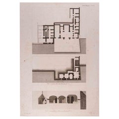
Joseph’s Well in the Citadel of Cairo – Section and Plan Engraving, Egypt 1776

Joseph’s Well in the Citadel of Cairo – Section and Plan Engraving, Egypt 1776

Located in Langweer, NL

Title: Joseph’s Well in the Citadel of Cairo – Section and Plan Engraving, Egypt 1776 Description: This detailed architectural engraving from 1776 presents the ground plan, sectiona...

Category

Antique Late 18th Century Dutch Prints

Materials

Paper

Waterworks Structure and Plan in Grand Cairo – Aqueduct System, Egypt 1776

Waterworks Structure and Plan in Grand Cairo – Aqueduct System, Egypt 1776

Located in Langweer, NL

Waterworks Structure and Plan in Grand Cairo – Aqueduct System, Egypt 1776 Description: This original architectural engraving from 1776 illustrates the ground plan and elevation of ...

Category

Antique Late 18th Century Dutch Prints

Materials

Paper

Rare Print of a Nilometer, a Structure Used to Calculate Taxes in Egypt, 1802

Rare Print of a Nilometer, a Structure Used to Calculate Taxes in Egypt, 1802

Located in Langweer, NL

How high is the water, mama? Johny Cash was asking his mother, when it is was '6 feet high and rising'. In Egypt it would probably mean that taxes that year would be low. In Egypt it all depended on the behavior of the Nile and a Priest, who would monitor the so-called Nilometer. A nilometer was a structure for measuring the Nile River's clarity and water level during the annual flood season. If the water level was low, there would be less food. If it was too high, it would be destructive. There was a specific mark that indicated how high the flood should be if the fields were to get good soil. Their predictions would determine how much money...

Category

Antique Early 1800s English Scientific Instruments
Materials

Paper

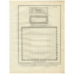
Mosque of Amr, Old Cairo & Sarcophagus Design – Architectural Print, Egypt 1776

Mosque of Amr, Old Cairo & Sarcophagus Design – Architectural Print, Egypt 1776

Located in Langweer, NL

Title: Mosque of Amr, Old Cairo, and Sarcophagus Design – Architectural Engraving, Egypt 1776 Description: This antique architectural engraving from 1776 features a detailed plan of...

Category

Antique Late 18th Century Dutch Prints

Materials

Paper

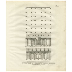
Hall of Joseph’s Granaries in Egypt – Floor Plan and Elevation Engraving, 1776

Hall of Joseph’s Granaries in Egypt – Floor Plan and Elevation Engraving, 1776

Located in Langweer, NL

Hall of Joseph’s Granaries in Egypt – Floor Plan and Elevation Engraving, 1776 Description: This antique architectural engraving from 1776 shows the floor plan and structural elevat...

Category

Antique Late 18th Century Dutch Prints

Materials

Paper

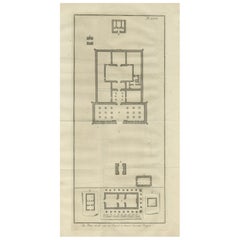
Ancient Temple Plans at Amara and Tentyra – Egyptian Architecture c.1710

Ancient Temple Plans at Amara and Tentyra – Egyptian Architecture c.1710

Located in Langweer, NL

Ancient Temple Plans at Amara and Tentyra – Egyptian Architecture c.1710 Description: This early 18th-century architectural engraving, titled "De Platte-Grond van vier Tempels te Am...

Category

Antique Early 18th Century Dutch Prints

Materials

Paper

You May Also Like

Original Antique Print of Cairo, Egypt. Dated 1809

Original Antique Print of Cairo, Egypt. Dated 1809

Located in St Annes, Lancashire

Wonderful image of Cairo Fine copper-plate engraving Published by Sherwood & Co. Dated 1809 Unframed. Free shipping

Category

Antique Early 1800s English Moorish Prints

Materials

Paper

F. CEPPARULI (*1750) after VANNI (*1750), "Temple on an Island in the Water"

F. CEPPARULI (*1750) after VANNI (*1750), "Temple on an Island in the Water"

Located in Madrid, ES

F. CEPPARULI (*1750) after VANNI (*1750), Temple on an Island in the Water, circa 1780 Copper engraving Francesco Cepparuli (before 1750 - after 1767 ) after Niccolo Vanni (before 1...

Category

Antique 18th Century Italian Baroque Drawings

Materials

Paint

Vintage Boho Italian Architectural Original Print

Vintage Boho Italian Architectural Original Print

Located in West Palm Beach, FL

This exceptional set of three vintage architectural prints captures the timeless precision of Italian Neoclassical design. Each work presents a detailed scholarly study, ranging from...

Category

Late 20th Century Italian Grand Tour Prints

Materials

Other