Want more images or videos?
Request additional images or videos from the seller
1 of 11

Religious Belief Map by A.K. Johnston – Moral and Statistical Chart 1852

$305.77per item
£227.04per item
€260per itemVAT Included
CA$429.13per item
A$435.01per item
CHF 247.42per item
MX$5,295.27per item
NOK 2,901.99per item
SEK 2,909.08per item
DKK 1,982.37per item
Quantity

About the Item

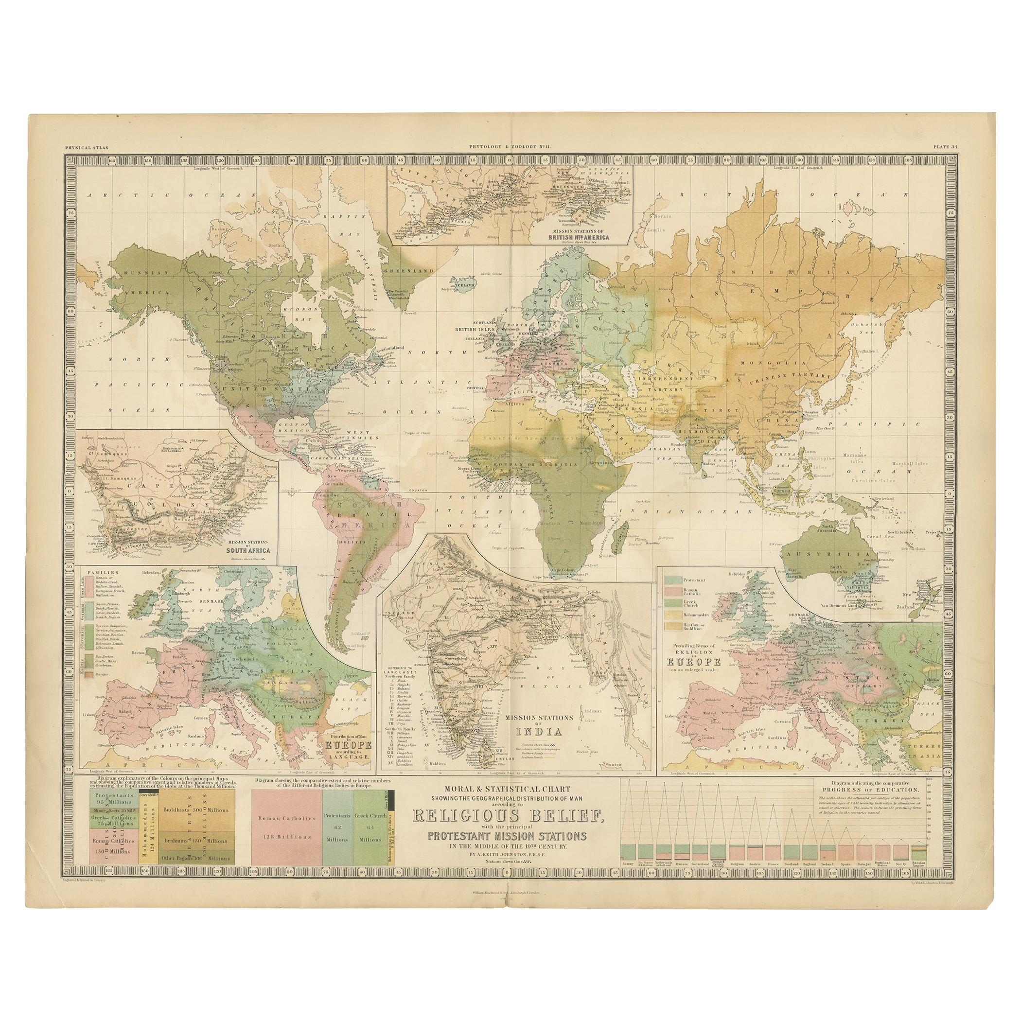
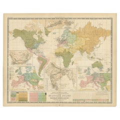
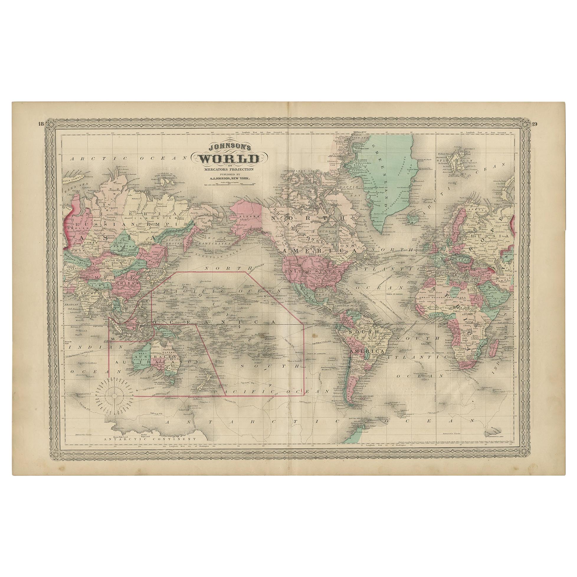
Religious Belief Map by A.K. Johnston – Moral and Statistical Chart 1852 This antique chart titled "Moral & Statistical Chart Showing the Distribution of Man According to Prevailing Forms of Religious Belief & the Proportionate Number of Each Creed in the Principal States of the Globe" was created by Alexander Keith Johnston and published in 1852 by William Blackwood & Sons in Edinburgh and London. Issued as Plate 18 in Johnston’s *Physical Atlas of Natural Phenomena*, this map is a rare and historically significant early attempt to visualize global religious demographics. The world is color-coded to reflect the dominant religions in various regions, including Christianity (with Roman Catholic, Greek Orthodox, and Protestant branches distinguished), Islam (Sunni and Shiite), Buddhism, Brahmanism (Hinduism), Judaism, and areas broadly labeled as "Heathen" or "Other Faiths," in accordance with 19th-century terminology. The color-coded legend to the lower right includes estimated numbers of adherents for each group, offering a numerical context to the geographic distribution. Each country or empire is labeled with estimates of its religious composition and population size, from the British Isles and Ottoman Empire to China, Russia, India, and the Americas. The chart reflects not only religious spread, but also the political-religious affiliations of empires and colonial powers during the mid-19th century. At the bottom of the chart is a diagram titled “Progress of Education,” using bar graphs to compare levels of literacy and schooling across nations—an early example of combining moral and statistical inquiry through cartography. Countries such as Prussia, Scotland, and Saxony rank highest in this education index, while others show much lower rates of public instruction, as interpreted from available data at the time. Alexander Keith Johnston (1804–1871), Geographer in Ordinary to Queen Victoria in Scotland, was a pioneer in thematic and scientific cartography. His *Physical Atlas* was one of the first atlases to integrate human, environmental, and physical data into visually compelling and educational maps. This plate is of particular interest to collectors of religious history, antique data visualization, and 19th-century worldviews. It reflects the empirical spirit of the age, while also serving as a historical document of cultural perspectives from a European scientific lens. Condition and framing tips: Very good antique condition with some mild age toning and a clean printed surface. Original centerfold as issued. Frame in a dark or neutral wood with a cream or parchment mat to complement the subtle pastel palette and enhance legibility. Ideal for display in a study, library, or historical institution.
  • Dimensions:
    Height: 10.79 in (27.4 cm)Width: 13.59 in (34.5 cm)Depth: 0.01 in (0.2 mm)
  • Materials and Techniques:
  • Place of Origin:
  • Period:
  • Date of Manufacture:
    1852
  • Condition:
    Very good condition. Light overall toning near the margins. The paper remains strong and well-preserved. Folding line as issued.
  • Seller Location:
    Langweer, NL
  • Reference Number:
    Seller: BG-13207-181stDibs: LU3054345393582

More From This Seller

View All
Antique Map Showing the Religions Around the World by Johnston '1854'

Antique Map Showing the Religions Around the World by Johnston '1854'

Located in Langweer, NL

Antique map titled 'Moral & Statistical Chart showing the Geographical Distribution of Man According to Religious Belief'. Rare large-size thematic map on the distribution of rel...

Category

Antique Mid-19th Century Maps

Materials

Paper

Ethnographic Map of the World by A.K. Johnston – Races of Man Chart 1852

Ethnographic Map of the World by A.K. Johnston – Races of Man Chart 1852

Located in Langweer, NL

Ethnographic Map of the World by A.K. Johnston – Races of Man Chart 1852 This antique map titled "Ethnographic Map of the World Showing the Present Distribution of the Leading Races...

Category

Antique Mid-19th Century Scottish Prints

Materials

Paper

Botanical Map by A.K. Johnston – Global Plant Distribution Chart 1852

Botanical Map by A.K. Johnston – Global Plant Distribution Chart 1852

Located in Langweer, NL

Botanical Map by A.K. Johnston – Global Plant Distribution Chart 1852 This remarkable antique chart titled "The Distribution of the Most Important Trees, Shrubs, Grains, & Fruits Ac...

Category

Antique Mid-19th Century Scottish Prints

Materials

Paper

Animal Distribution Map by A.K. Johnston – Fauna by Climate Zones 1852

Animal Distribution Map by A.K. Johnston – Fauna by Climate Zones 1852

Located in Langweer, NL

Animal Distribution Map by A.K. Johnston – Fauna by Climate Zones 1852 This beautifully engraved chart titled "The Distribution of Animals Including the Mammalia, Birds, Reptiles & ...

Category

Antique Mid-19th Century Scottish Prints

Materials

Paper

Antique Charts of the World – Physical Features and Ethnographical Map, 1884

Antique Charts of the World – Physical Features and Ethnographical Map, 1884

Located in Langweer, NL

Antique Charts of the World – Physical Features and Ethnographical Map, 1884 Description: This fascinating double plate from the New and Revised Edition of Black’s General Atlas of ...

Category

Antique 1880s Scottish Maps

Materials

Paper

Biblical World Map of the Descendants of Noah — Wilkinson Atlas Classica, 1827

Biblical World Map of the Descendants of Noah — Wilkinson Atlas Classica, 1827

Located in Langweer, NL

Antique Biblical World Map Descendants of Noah Asia Europe Africa Wilkinson 1827 This fascinating and highly decorative early nineteenth-century biblical world map was published in ...

Category

Antique Early 19th Century British Maps

Materials

Paper

You May Also Like

Large Original Antique Map of The World, Fullarton, C.1870

Large Original Antique Map of The World, Fullarton, C.1870

Located in St Annes, Lancashire

Great map of the World. Showing both hemispheres From the celebrated Royal Illustrated Atlas Lithograph. Original color. Published by Fullarton, Edinburgh, C.1870 Unframed. Rep...

Category

Antique 1870s Scottish Maps

Materials

Paper

1864 Original illustrated planisphere - World Map - Geography

1864 Original illustrated planisphere - World Map - Geography

Located in PARIS, FR

Immerse yourself in the epic journey of the past with the Illustrated Historical Planisphere of 1864 by Charpentier! 🗺️ This cartographic treasure transports you through the intrica...

Category

1860s Prints and Multiples

Materials

Linen, Paper, Lithograph

Original Antique Map of The World by Thomas Clerk, 1817

Original Antique Map of The World by Thomas Clerk, 1817

Located in St Annes, Lancashire

Great map of The Eastern and Western Hemispheres On 2 sheets Copper-plate engraving Drawn and engraved by Thomas Clerk, Edinburgh. Published by Mackenzie And Dent, 1817 ...

Category

Antique 1810s English Maps

Materials

Paper

Original Antique Map of The World by Dower, circa 1835

Original Antique Map of The World by Dower, circa 1835

Located in St Annes, Lancashire

Nice map of the World Drawn and engraved by J.Dower Published by Orr & Smith. C.1835 Unframed. Free shipping

Category

Antique 1830s English Maps

Materials

Paper

Large Original Vintage Map of North America, circa 1920

Large Original Vintage Map of North America, circa 1920

Located in St Annes, Lancashire

Great map of North America Original color. Good condition Published by Alexander Gross Unframed.  

Category

Vintage 1920s English Edwardian Maps

Materials

Paper

Large Original Antique Map of the World, Fullarton, circa 1870

Large Original Antique Map of the World, Fullarton, circa 1870

Located in St Annes, Lancashire

Great map of the World. From the celebrated Royal Illustrated Atlas Lithograph. Original color. Published by Fullarton, Edinburgh, circa 1870. Unframed.

Category

Antique 1870s Scottish Maps

Materials

Paper