Want more images or videos?
Request additional images or videos from the seller
1 of 11

Animal Distribution Map by A.K. Johnston – Fauna by Climate Zones 1852

$307.19per item
£226.68per item
€260per itemVAT Included
CA$425.94per item
A$432.62per item
CHF 249.31per item
MX$5,223.28per item
NOK 2,895.95per item
SEK 2,920.11per item
DKK 1,982.46per item
Quantity

About the Item

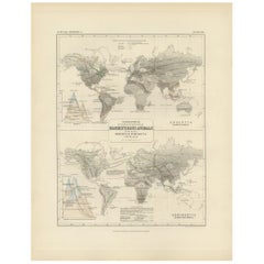
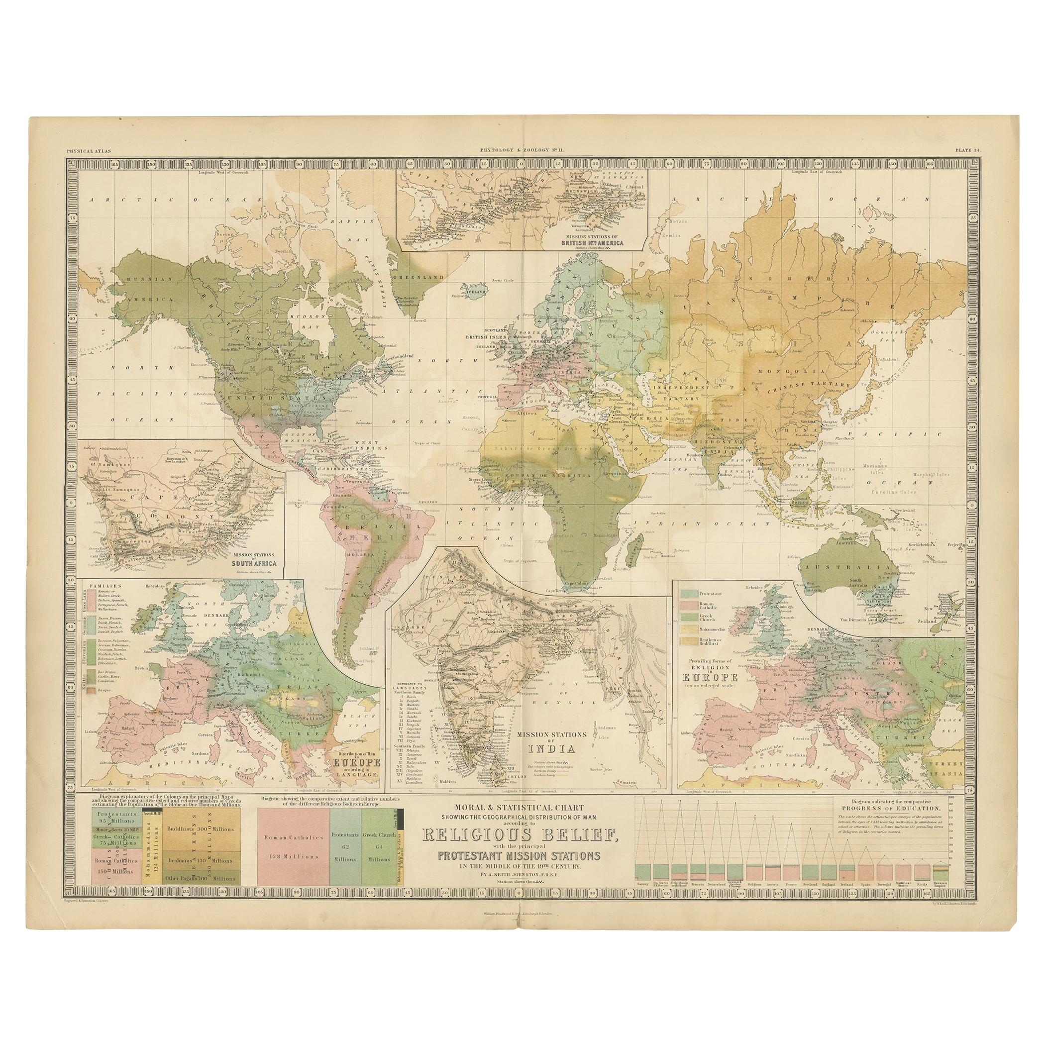
Animal Distribution Map by A.K. Johnston – Fauna by Climate Zones 1852 This beautifully engraved chart titled "The Distribution of Animals Including the Mammalia, Birds, Reptiles & Fishes; According to Zones of Climate" was created by Alexander Keith Johnston and published in 1852 by William Blackwood & Sons, Edinburgh and London. It appears as Plate 16 in Johnston’s influential *Physical Atlas of Natural Phenomena*, one of the most important thematic atlases of the 19th century. This map presents a global view of the natural distribution of animals based on climatic zones, highlighting how temperature, geography, and elevation influence animal habitats. The world is divided into major climate zones such as the "Temperate Fauna," "Tropical Fauna," and "Zones of Perpetual Ice and Snow," with red typography identifying characteristic species of mammals, birds, reptiles, and marine life in each region. Notable animal groups are labeled in situ, such as the polar bear, right whale, llama, lion, elephant, condor, kangaroo, and reindeer. Faunal regions across Asia, Africa, the Americas, Australia, and the Arctic are described in broad zoological terms. The map distinguishes between terrestrial and marine fauna, with references to oceanic zones for species like whales and seals, while also noting elevation-related changes in animal life. Beneath the main map is a detailed comparative diagram titled "Distribution of Animals in a Vertical Direction," showing how animal species vary with altitude across major mountain systems in the Western and Eastern Hemispheres. Mountains like the Andes, Alps, Himalayas, and the Rocky Mountains are illustrated with fauna labeled at different heights—from mountain goats and condors to tigers and leopards—illustrating the vertical stratification of animal habitats. Alexander Keith Johnston (1804–1871) was a pioneer in thematic cartography and served as Geographer in Ordinary to Queen Victoria. His *Physical Atlas* combined scientific rigor with visual clarity and artistic precision, making complex environmental and biological data both accessible and visually compelling. This plate is ideal for collectors of natural history, early zoological science, or antique educational prints. It also serves as an elegant decorative piece for libraries, studies, or offices with a scientific or historical theme. Condition and framing tips: Very good condition with mild age toning and a clean image area. Original centerfold present. Frame in dark wood or black with a neutral or ivory mat to enhance the subtle red and green tones and the delicate engravings. A fine piece for natural history enthusiasts and vintage map collectors alike.
  • Dimensions:
    Height: 10.79 in (27.4 cm)Width: 13.59 in (34.5 cm)Depth: 0.01 in (0.2 mm)
  • Materials and Techniques:
  • Place of Origin:
  • Period:
  • Date of Manufacture:
    1852
  • Condition:
    Very good condition. Light overall toning near the margins and some offset over Europe. The paper remains strong and well-preserved. Folding line as issued.
  • Seller Location:
    Langweer, NL
  • Reference Number:
    Seller: BG-13207-161stDibs: LU3054345393532

More From This Seller

View All
Antique Map Showing the Division and Distribution of Mammals by Johnston '1850'

Antique Map Showing the Division and Distribution of Mammals by Johnston '1850'

Located in Langweer, NL

Antique map titled 'Geographical division and distribution of mammiferous animals of the orders rodentia and ruminantia over the globe'. Original antique map showing geographical div...

Category

Antique Mid-19th Century Maps

Materials

Paper

Botanical Map by A.K. Johnston – Global Plant Distribution Chart 1852

Botanical Map by A.K. Johnston – Global Plant Distribution Chart 1852

Located in Langweer, NL

Botanical Map by A.K. Johnston – Global Plant Distribution Chart 1852 This remarkable antique chart titled "The Distribution of the Most Important Trees, Shrubs, Grains, & Fruits Ac...

Category

Antique Mid-19th Century Scottish Prints

Materials

Paper

Ethnographic Map of the World by A.K. Johnston – Races of Man Chart 1852

Ethnographic Map of the World by A.K. Johnston – Races of Man Chart 1852

Located in Langweer, NL

Ethnographic Map of the World by A.K. Johnston – Races of Man Chart 1852 This antique map titled "Ethnographic Map of the World Showing the Present Distribution of the Leading Races...

Category

Antique Mid-19th Century Scottish Prints

Materials

Paper

Antique Map Showing the Division and Distribution of Mammals by Johnston '1850'

Antique Map Showing the Division and Distribution of Mammals by Johnston '1850'

Located in Langweer, NL

Antique map titled 'Geographical division and distribution of mammiferous animals of the orders quadrumana, edentata, marsupialia & pachydermata'. Original antique map showing the ge...

Category

Antique Mid-19th Century Maps

Materials

Paper

River Systems Map of the World by A.K. Johnston – Educational Print 1852

River Systems Map of the World by A.K. Johnston – Educational Print 1852

Located in Langweer, NL

River Systems Map of the World by A.K. Johnston – Educational Print 1852 This striking 1852 map titled "The River Systems of the World" was created by the noted Scottish geographer ...

Category

Antique Mid-19th Century Scottish Prints

Materials

Paper

You May Also Like

Original Antique Map of The World by Thomas Clerk, 1817

Original Antique Map of The World by Thomas Clerk, 1817

Located in St Annes, Lancashire

Great map of The Eastern and Western Hemispheres On 2 sheets Copper-plate engraving Drawn and engraved by Thomas Clerk, Edinburgh. Published by Mackenzie And Dent, 1817 ...

Category

Antique 1810s English Maps

Materials

Paper

1864 Original illustrated planisphere - World Map - Geography

1864 Original illustrated planisphere - World Map - Geography

Located in PARIS, FR

Immerse yourself in the epic journey of the past with the Illustrated Historical Planisphere of 1864 by Charpentier! 🗺️ This cartographic treasure transports you through the intrica...

Category

1860s Prints and Multiples

Materials

Linen, Paper, Lithograph

Large Original Antique Map of The World, Fullarton, C.1870

Large Original Antique Map of The World, Fullarton, C.1870

Located in St Annes, Lancashire

Great map of the World. Showing both hemispheres From the celebrated Royal Illustrated Atlas Lithograph. Original color. Published by Fullarton, Edinburgh, C.1870 Unframed. Rep...

Category

Antique 1870s Scottish Maps

Materials

Paper

Original Antique Map of The World by Dower, circa 1835

Original Antique Map of The World by Dower, circa 1835

Located in St Annes, Lancashire

Nice map of the World Drawn and engraved by J.Dower Published by Orr & Smith. C.1835 Unframed. Free shipping

Category

Antique 1830s English Maps

Materials

Paper

Map of the World - Original Etching - 1820

Map of the World - Original Etching - 1820

Located in Roma, IT

Map of the World is an Original Etching realized by an unknown artist of 19th century in 1820. Very good condition on two sheets of white paper joine...

Category

1820s Modern Figurative Prints

Materials

Etching

Antique Map of Eastern Hemisphere from the collection of Thierry Despont

Antique Map of Eastern Hemisphere from the collection of Thierry Despont

Located in New York, NY

Designed by Enrico Bonetti (E. Bonatti) and published by Francesco Vallardi Editore. Based on an earlier map by Evangelista Azzi (Ev. Azzi). Labeled as such at bottom edge of map. T...

Category

Antique Late 19th Century Italian Maps

Materials

Canvas, Wood